A few days after the celebrations marking the eighth centenary of the death of Francis of Assisi, there is one particularly concrete way of approaching his figure: start walking.
Not necessarily in order to reproduce, step by step, the movements of a thirteenth-century man. Eight centuries are far too many for that. Roads, borders, villages and landscapes have all changed. But in central Italy there remains an extraordinary constellation of places bound to his life and to the memory left behind by the first Franciscan communities: hermitages hidden among woods, convents, small medieval towns, sanctuaries and paths crossing the Apennines.
For years, many of those itineraries have grown independently. Some have their own associations, credentials, pilgrim accommodation and established waymarking. Others have been added more recently. What is new in 2026 is the attempt to see them as parts of a single geography.
On 30 July, the Italian Ministry of Tourism presented the Cammino di Francesco – Il Cammino della Luce, a network bringing existing routes together under a common identity. In total it covers 1,546 kilometres, including variants and branches, across Abruzzo, Emilia-Romagna, Lazio, Marche, Tuscany and Umbria. Assisi appears as its centre of gravity and, for a good many pilgrims, as its final destination.
This is not, therefore, a new “Camino de Santiago” drawn onto the map in one stroke. It is something possibly more interesting: a network being built out of roads that already had lives of their own.
From many roads to a single network
The present project began to take institutional shape in 2022, when an Italian law created the National Committee responsible for the celebrations of the eighth centenary. Among its tasks was the express promotion of the places and roads connected with Francis.
The next step came on 28 October 2025 with the founding of the association Vie e Cammini di Francesco, conceived to bring together public administrations, regions, territories and representatives of the Franciscan world. Its aim is not merely promotional. The association also intends to work on waymarking, conservation of the paths, hospitality, assistance to walkers, accessibility, communication and common standards.
That explains why the current map looks less like a motorway and more like a railway network: there are different starting points and different corridors that eventually meet.
For anyone who wants to walk, these are the principal routes.
From Florence to La Verna by the North
The first possibility sets out from the heart of Florence and reaches the sanctuary of La Verna, one of the essential places in Franciscan geography.
The so-called northern line covers 101.2 kilometres over six stages: Firenze–Pontassieve, Pontassieve–Passo della Consuma, Consuma–Stia, Stia–Camaldoli, Camaldoli–Badia Prataglia and Badia Prataglia–La Verna.
Its character is shaped by the Casentino and its great stretches of woodland. The presence of Camaldoli, with its monastic tradition, adds a further layer to a route in which nature and religious heritage continually intersect. For planning stages and downloading the GPX track, the safest reference is the official Italia.it page: Firenze–La Verna, northern line.
From Florence to La Verna by the South
The second Florentine departure is somewhat shorter: 90.2 kilometres over six stages. The route links Firenze, Rignano, Vallombrosa, Montemignaio, Poppi, Bibbiena and finally La Verna. Compared with the northern route, this alternative finds one of its strong points in Vallombrosa and passes through some of the best-known towns of the Casentino.
It is not simply a variant designed to “get there sooner.” It is another way of entering the same landscape. The practical page, with cartography and GPX, can be consulted at Italia.it: Firenze–La Verna, southern line, or Cammino Inferiore.
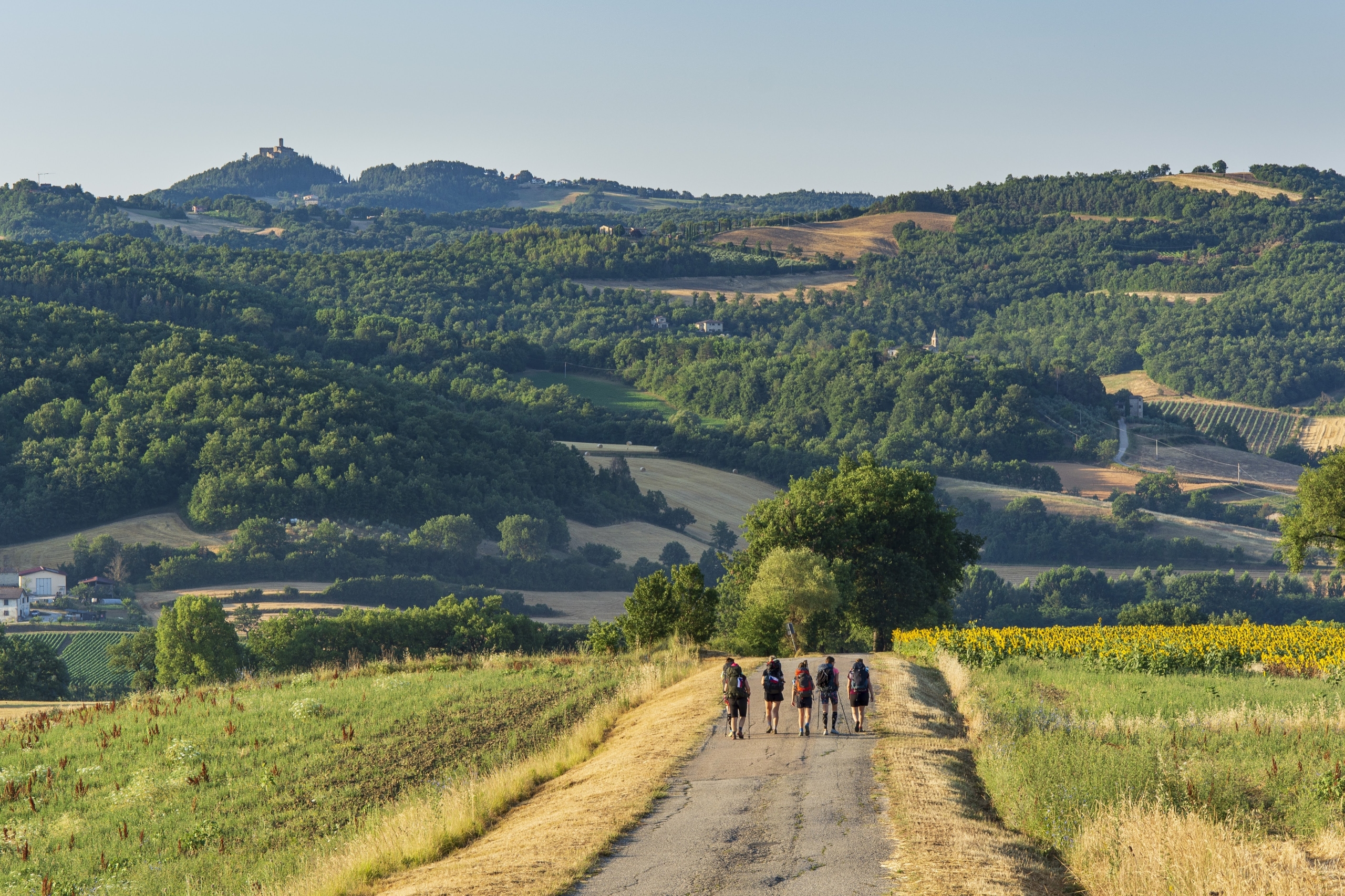
From Rimini to La Verna
From the Adriatic comes one of the best-organised roads in the whole network. The itinerary between Rimini and La Verna was established as a structured route in 2013 and retains its own managing association.
It covers approximately 107–110 kilometres over five days: Rimini–Villa Verucchio, Villa Verucchio–San Leo, San Leo–Sant’Agata Feltria, Sant’Agata Feltria–Balze di Verghereto and Balze–La Verna.
From San Leo onwards the terrain becomes more demanding, and the final stages are classified by the route’s own managers as days requiring real effort. Its advantage is an already developed infrastructure: credential, guidebook, accommodation network, notices on the route and even some luggage transfer services.
For precisely that reason, in addition to the national Italia.it page, it is worth consulting the official website of the Cammino di San Francesco da Rimini a La Verna before setting out, where stages and possible incidents are kept up to date.
From La Verna to Assisi via Pieve Santo Stefano
From La Verna begins one of the great corridors toward Assisi. The route passing through Pieve Santo Stefano totals approximately 189.6 kilometres, distributed across some ten main days.
The road crosses Cerbaiolo, Sansepolcro, Citerna, Città di Castello, Pietralunga, Gubbio and Valfabbrica before arriving at Assisi. It would be difficult to find anywhere in the network such a dense succession of places connected with the Franciscan tradition.
It also demands a degree of preparation. Some stages approach or exceed thirty kilometres and cross wooded or sparsely populated sections. The national reference is Italia.it: La Verna–Assisi via Pieve Santo Stefano. For accommodation, waymarking and services in the Umbrian section, the La Via di Francesco portal is particularly useful.
From La Verna to Assisi via Caprese Michelangelo
There is another possibility from La Verna, of around 185.5 kilometres, which moves into more mountainous country passing through Caprese Michelangelo and the Anghiari area.
Its first day already gives a hint of the route’s character: between La Verna and Caprese Michelangelo there is roughly 1,170 metres of ascent. Along the way appear places such as the Eremo della Casella and the Alpe di Catenaia.
It is probably an option for those looking for something more than added kilometres and willing to take on greater elevation. Since the stage organisation published in 2026 still presents some points worth checking before departure, it is particularly important here to consult the updated track at Italia.it: La Verna–Assisi via Caprese Michelangelo.
From Rome to Assisi via the Salaria
The great southern approach begins beside another of Europe’s major pilgrimage centres: Rome. The Salaria route covers approximately 247 kilometres. It leaves the area of St Peter’s, crosses Monte Sacro and Monterotondo and continues through the Sabina to Rieti. There it enters one of the territories most closely associated with Francis: Poggio Bustone, Greccio, La Foresta and Fonte Colombo.
It then continues toward Piediluco, Spoleto, Trevi and Foligno before reaching Assisi. It is not a uniform route. It alternates urban exits, rural tracks, valleys and mountain sections, so daily distance is not the only factor to take into account.
The itinerary and GPX files are available at Italia.it: Roma–Assisi via the Salaria. For the Umbrian section, the data can be supplemented with La Via di Francesco.
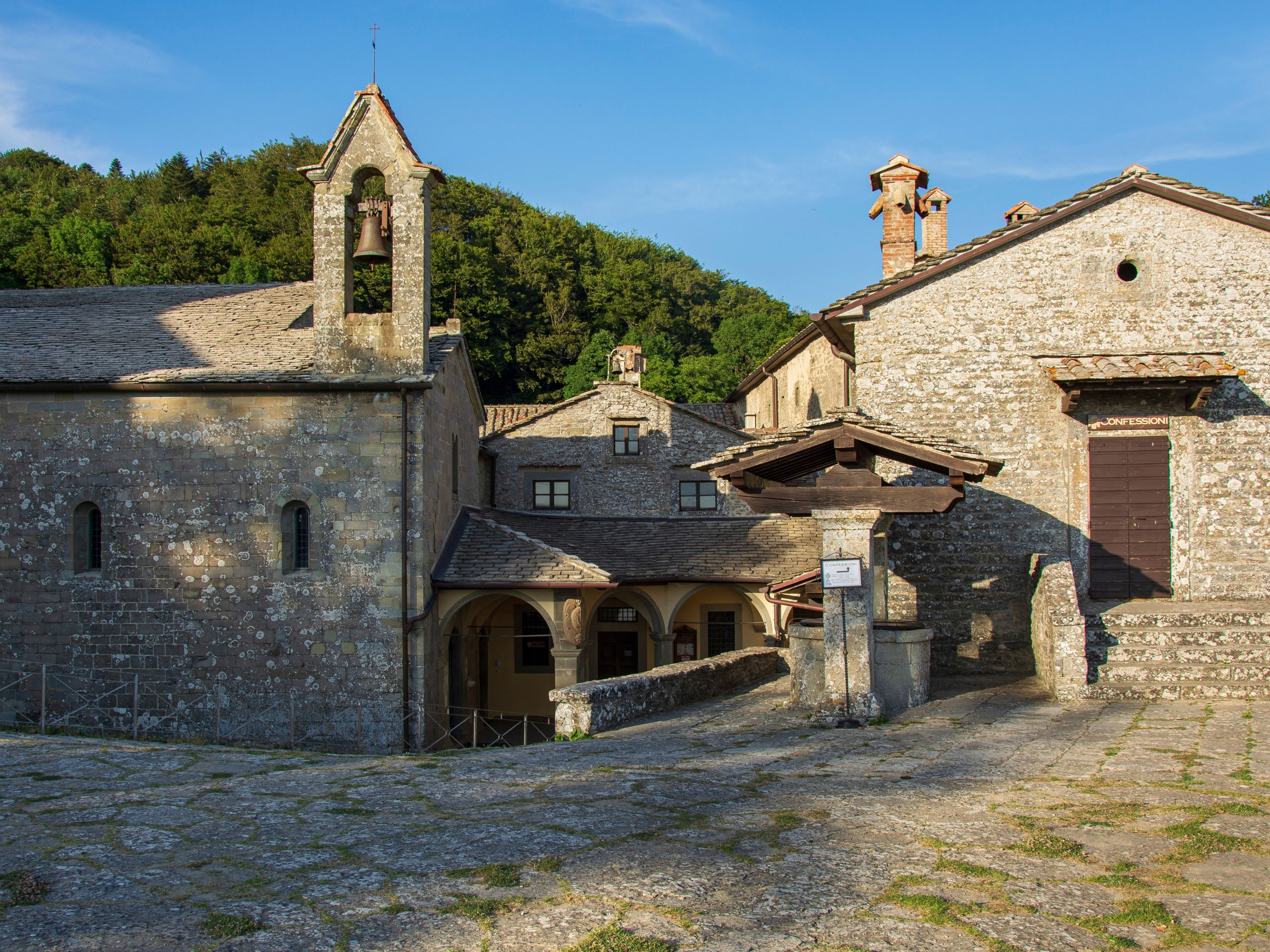
From Rome to Assisi via the Tiberina
Rome also has a second gateway into the network: the Tiberina. The route passes through Monterotondo, Fara in Sabina, Poggio Mirteto, Collevecchio and Configni as far as Greccio, where it connects with the system continuing toward Assisi.
In this case it is worth paying particular attention to planning: the national page combines the overall distance to Assisi with the initial stages as far as Greccio, so the most prudent approach is to work from the current cartography and GPX. Official information can be found at Italia.it: Roma–Assisi via the Tiberina.
The Valle Santa di Rieti Ring
Not every road in the network requires two weeks. The Anello della Valle Santa di Rieti offers 63.1 kilometres over three days. It is a particularly concentrated circuit: it links the four great Franciscan sanctuaries of the area — Greccio, Fonte Colombo, La Foresta and Poggio Bustone.
Given its length, it can work as an introduction to this kind of pilgrimage, or as a route in its own right for anyone with only a few days available. Map and practical details are available at Italia.it: Anello della Valle Santa di Rieti.
From Ascoli Piceno to Assisi
From the Marche comes the Cammino Francescano della Marca, some 167 kilometres over eight stages. Ascoli Piceno–Venarotta–Comunanza–Sarnano–Montalto di Cessapalombo–Polverina–Colfiorito–Foligno–Assisi: the route crosses the Umbrian-Marchigian Apennines and passes through territories that in recent years have also had to rebuild after earthquakes.
Here the road takes on a very visible territorial dimension. Hospitality structures known as Spedali have been established, and municipalities and associations take part in their upkeep.
The most useful page for walking it is that of the Cammino Francescano della Marca itself, because it also publishes modifications and diversions. There is in addition a general page on Italia.it.
The Road of Francis in Abruzzo
Abruzzo contributes a distinct piece to the network. Its official route totals 87.4 kilometres over eleven relatively short stages and crosses Fonteavignone, Rocca di Mezzo, Rovere, Ovindoli, Celano, Aielli, Collarmele, Gagliano Aterno, Castelvecchio Subequo, Secinaro and the Sirente area.
Here the experience is shaped by the Altopiano delle Rocche, the Valle Subequana and the mountain landscapes of the Abruzzese interior. The memory of Tommaso da Celano, one of Francis’s earliest biographers, also appears.
That the stages are short does not necessarily mean they are easy: altitude and weather can weigh more heavily than the kilometres. Practical information and GPX files can be found at Italia.it: Cammino di Francesco in Abruzzo.
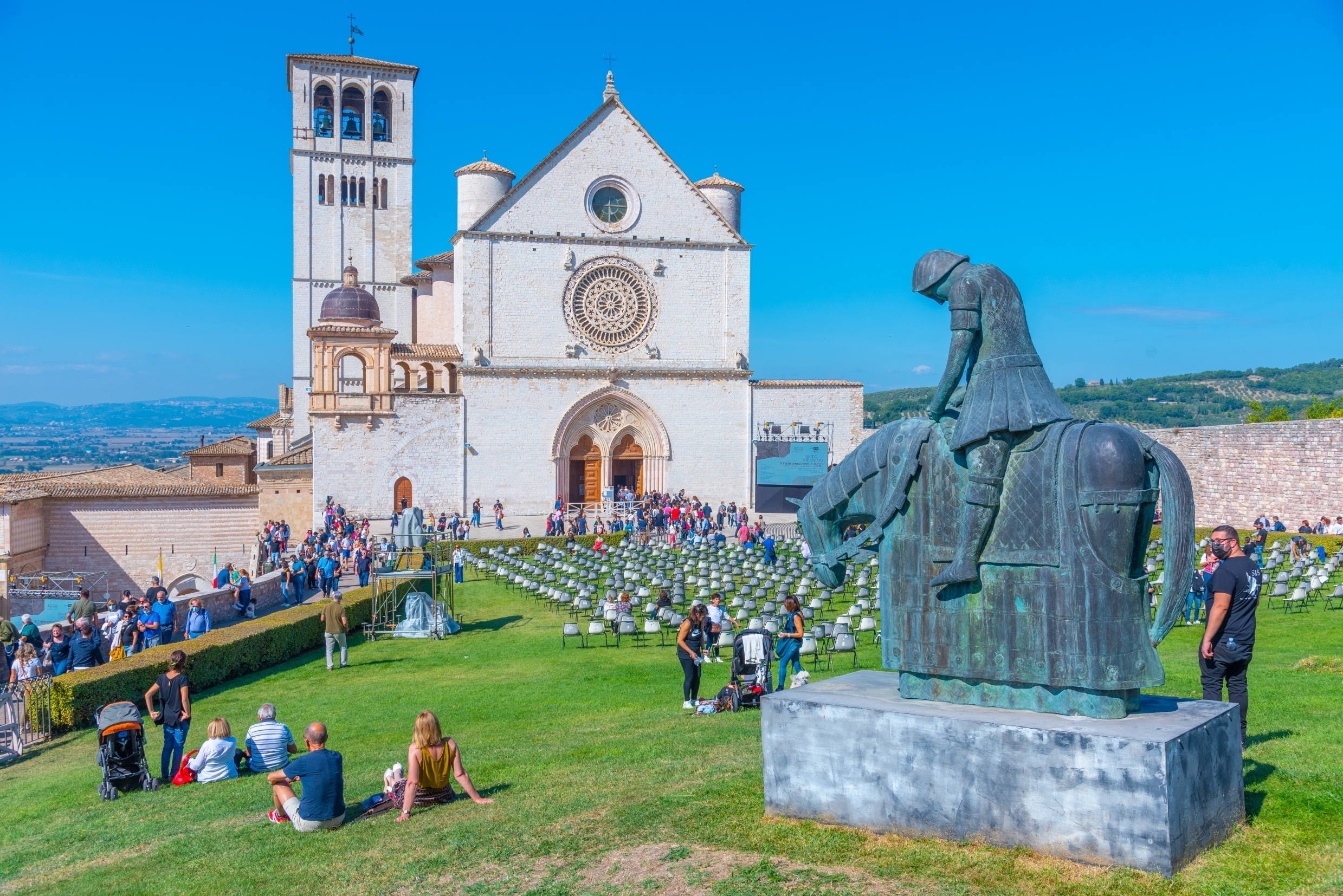
Arriving in Assisi: the Credential and the Testimonium
For many walkers, all these corridors converge on a single image: the arrival in Assisi. Along the route it is possible to use the Credenziale del Pellegrino, stamped at different stages and serving as a record of the journey made. On the Via di Francesco it can be requested in advance, and it is recognised by the Franciscan institutions connected with the pilgrimage.
On reaching the Statio Peregrinorum of the Sacro Convento, you can request the Testimonium Viae Francisci, the closest Franciscan equivalent to the Compostela. To receive it you must have covered at least 100 kilometres on foot or 200 kilometres by bicycle to Francis’s tomb. Those who have completed a shorter distance may request the Chartula Peregrini. Information on the credential can be consulted at La Via di Francesco, and the institutional reference for the basilica is sanfrancescoassisi.org.
A road beginning to speak several languages
The national project is born with an advantage that many tourist routes take decades to acquire: before it had a common brand, it already had pilgrims. In 2024 the Statio Peregrinorum in Assisi registered 4,483 arrivals. More than 80% were people who had walked the Via di Francesco. And practically half came from abroad. Germany accounted for 11.95% of those registered; the United States, 5.62%; France, 5.18%. These are figures predating the presentation of the national network, which makes them useful precisely as evidence that the international dimension is not an aspiration born in 2026: it was already there.
What begins now is a different phase. The objective for the coming years seems to be less about drawing new hundreds of kilometres than about making those that already exist work increasingly as a system: more consistent information, recognisable waymarking, better coordination between regions, accommodation providers and associations, digital updating of the routes, and a common international promotion.
Italia.it already provides a single point of entry, and the project has also been incorporated into its digital ecosystem. At the same time, the local roads retain the knowledge of the terrain accumulated over years. The association Vie e Cammini di Francesco has precisely the task of bringing those two scales together.
Eight centuries after the death of Francis, the singularity of this pilgrimage does not set out to prove that every present-day path coincides exactly with a footprint left in the thirteenth century. Its strength lies elsewhere: in linking places where, for eight hundred years, different communities have preserved the memory of one person and of a particular way of relating to the landscape, to others, and to the road itself.
AI Transparency Notice
PilgriMaps uses artificial intelligence tools to assist in the research, drafting and translation of editorial content. All AI-assisted content is reviewed, edited and verified by our editorial team before publication. We contrast information against primary sources, specialist literature and on-the-ground knowledge to ensure accuracy, cultural sensitivity and editorial integrity.
AI is one tool among many in our workflow. The judgement, curation and responsibility for everything published on this platform remain entirely human.
Viator Media S.L. — in compliance with the EU Artificial Intelligence Act (Regulation EU 2024/1689).