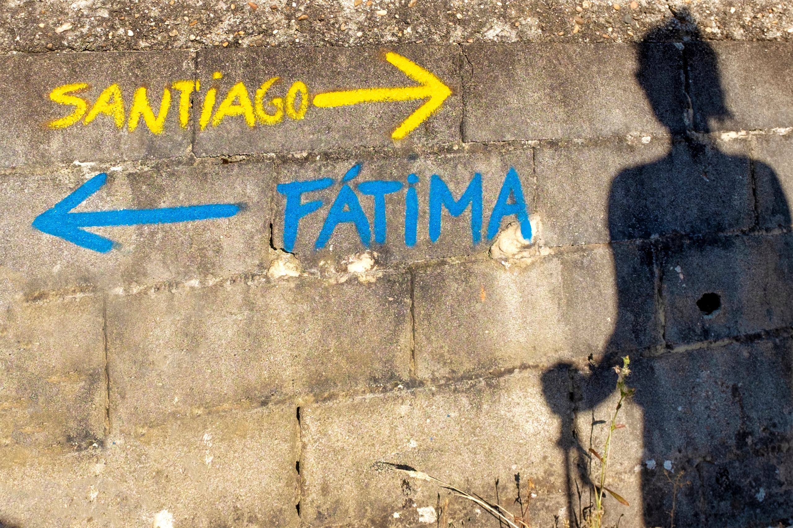
If you have walked the Camino Português north toward Santiago, you have already seen them without necessarily knowing what they were: blue arrows, painted alongside the yellow ones, pointing back the way you came.
They are not a mistake. They belong to a second pilgrimage network running in the opposite direction, toward a shrine that did not exist until 1917 and now receives more than six million people a year. The Caminhos de Fátima are less internationally famous than the roads to Compostela, largely because until now nothing awaited the walker at the end but the Sanctuary itself. That changes on 12 October, when Fátima issues its first official pilgrim certificate.
Which makes this a good moment to look at what the network actually consists of.
What They Are
The Caminhos de Fátima are a network of religious and cultural itineraries beginning in various places and ending at the Sanctuary of Fátima, developed or certified by the Centro Nacional de Cultura in partnership with multiple institutions and in collaboration with the Sanctuary, creating safe and pleasant conditions for pilgrims by avoiding busy roads in favour of dirt tracks and small rural lanes.
That last clause is the design principle, and it matters. These routes were not drawn by tracing the shortest line to Fátima. They were assembled from field paths, municipal tracks and rights of way, deliberately keeping walkers off the N-roads.
The Centro Nacional de Cultura is a private cultural association of public utility founded in 1945, which has held the Caminhos de Fátima trademark since 1998. The original route, the Caminho do Tejo with its blue waymarkers, came out of the work of Helena Vaz da Silva and Gonçalo Ribeiro Telles. The Associação de Amigos dos Caminhos de Fátima followed in 2008.
There are currently seven.
The Seven Routes
Caminho do Norte ao Centro — Valença to Fátima, 364 km, 17 days.
The long one, and the one that connects the two great Iberian pilgrimages. It begins at the Portuguese border town opposite Tui, where pilgrims cross the Minho heading for Santiago, and runs the length of northern and central Portugal in the opposite direction. Seventeen days is a serious commitment, comparable to the Camino Francés from Burgos. It is also the route that makes the blue arrows make sense.
Caminho do Centenário — Vila Nova de Gaia to Fátima, 212 km.
From the south bank of the Douro, opposite Porto. Named for the 1917 centenary, it covers the central Portuguese interior over roughly ten to twelve days depending on how the stages are split. A strong option for anyone flying into Porto.
Caminho do Tejo — Lisbon to Fátima, 150 km, 6 days.
The classic, and the one most walked. It starts at the Parque das Nações beside the Tagus estuary, though you can add an 11 km approach from the Sé Patriarcal through Alfama and the Castle hill if you want to begin in the old city. From there it follows the river north through Póvoa de Santa Iria, Alverca, Vila Franca de Xira, Azambuja and Santarém before turning inland through Minde and climbing to the Cova da Iria. Six days, graded easy, with the Tagus as company for the first half. If you walk one Caminho de Fátima, walk this.
Rota Carmelita — Coimbra to the Sanctuary, 111 km.
The newest addition to the family, linking the Carmelite house at Coimbra — where Sister Lúcia, the surviving seer of the 1917 apparitions, lived from 1948 until her death in 2005 — with the field where she saw what she saw as a child. The biographical logic is unusually neat: you walk from the end of her life to the beginning of the story.
Caminho do Médio Tejo — three routes, roughly 220 km in total.
A partnership between the CNC and the Médio Tejo intermunicipal community, converging on Fátima from three directions. From Tomar, 31 km in a single day — the shortest of all the routes, created partly for Santiago pilgrims who want to add Fátima to their itinerary. From Abrantes, 91 km over four days. From Sertã, 98 km over five days, through the most broken terrain of the network: a landscape of ridges, slopes and valleys cut by streams feeding the Tagus. Probably the hardest walking of any Caminho de Fátima, and by several accounts the most beautiful.
Caminho dos Candeeiros — Rio Maior to Fátima, 63 km, 3 days.
Crosses the Serra dos Candeeiros limestone massif. Three days, which makes it the natural choice for a long weekend.
Caminho da Nazaré — Nazaré to Fátima, 54 km, 3 days.
The shortest multi-day route, connecting the Atlantic coast and the Marian shrine of Nossa Senhora da Nazaré to the Cova da Iria. Sea to sanctuary in three days. For anyone with limited time who still wants the experience of arriving on foot, this is the one.
Fátima Launches Its Own Pilgrim Certificate: Just 13 Kilometres to Qualify
The Practicalities
The credencial. A pilgrim credencial for the Caminhos de Fátima already exists and can be stamped along the way — at museums, churches, municipal offices and other points marked in the official route guides. If you intend to claim the new certificate, get one before you start and have it stamped consistently. The criteria for the certificate have not yet been published, but no pilgrimage authority anywhere has ever issued a document to someone with an empty credencial.
Waymarking. Blue arrows and blue-and-white markers, the reverse of the Jacobean yellow. On shared stretches with the Camino Português you will see both. Follow the blue and you are heading for Fátima; follow the yellow and you are heading for Santiago.
Maps and the app. Full route guides and cartography are available to consult and download at caminhosdefatima.org, and there is a free Caminhos de Fátima app on Google Play and the App Store. Download the tracks for offline use before you set out — several stages pass through areas with thin coverage.
Storm damage. In March 2026 the CNC published a notice on the impact of recent storms on the routes. Check the news section of the official site before committing to a specific itinerary, particularly on the wooded northern and Médio Tejo sections where fallen trees and damaged waymarking take time to clear.
When to go. Spring and autumn. Portuguese summers on the Tagus plain are hot and exposed, and the interior stretches offer little shade. If you want to arrive for one of the great pilgrimages, the dates are 13 May and 13 October, and you should expect crowds accordingly.
Difficulty. The Caminho do Tejo is rated easy. Candeeiros and Nazaré are moderate. Sertã and the northern routes involve real climbing. All are walkable or cyclable, and the routes were explicitly designed for both.
Which One
For a first Caminho de Fátima, the Caminho do Tejo. Six days, easy grading, good transport at both ends, and the Tagus alongside you for the opening stages.
For a long weekend, Nazaré — three days from the Atlantic, with the coast behind you and the sanctuary ahead.
For pilgrims already walking to Santiago, the Rota de Tomar. One day, 31 kilometres, and it was designed precisely for you.
For anyone wanting the full undertaking, Valença to Fátima: 364 kilometres and seventeen days, starting where the Camino Português crosses into Portugal and walking the whole country in reverse.
The Field at the End
All seven end in the same place: the Cova da Iria, an unremarkable patch of ground outside a village in the Serra de Aire where three shepherd children said they saw something in 1917. By that October there were seventy thousand people standing in it.
What every one of these routes does is slow the arrival down. You reach the Sanctuary having spent days in the Portuguese countryside — the Tagus flood plain, the limestone of the Candeeiros, the broken hills above the Sertã — rather than stepping off a coach into the esplanade.
From this October, there will be a document to say so. But the document is not the point, and the Sanctuary knows it. The certificate exists because pilgrims kept asking for one, which is to say: because enough people were already walking.
AI Transparency Notice
PilgriMaps uses artificial intelligence tools to assist in the research, drafting and translation of editorial content. All AI-assisted content is reviewed, edited and verified by our editorial team before publication. We contrast information against primary sources, specialist literature and on-the-ground knowledge to ensure accuracy, cultural sensitivity and editorial integrity.
AI is one tool among many in our workflow. The judgement, curation and responsibility for everything published on this platform remain entirely human.
Viator Media S.L. — in compliance with the EU Artificial Intelligence Act (Regulation EU 2024/1689).
This post is also available in: