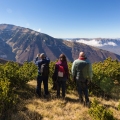
The pilgrim reaches Roncesvalles after crossing the Pyrenees. They may have come down through beech woods wrapped in mist, under rain, or with the wind hammering the slopes. Ahead appear the roofs and stone walls of a place that seems made to receive walkers. Today they will find a hostel, a credencial to be stamped, and signs pointing the way onward. Centuries ago they would have found, above all, hospitality.
Roncesvalles looks like the natural beginning of the Camino Francés, but historically it is rather the opposite: it was an arrival. Medieval pilgrims did not start there. They came from different parts of Europe and, on reaching Roncesvalles, had just overcome one of the greatest obstacles of the journey: the Pyrenees.
For many walkers today, however, this small Navarrese enclave is the point where a route of around 750 kilometres to Santiago de Compostela begins. Between the one thing and the other lie almost a thousand years of history.
A gateway in the Pyrenees
In truth, there was never a single starting point for the Camino Francés. The medieval pilgrim began walking from their own front door and joined, step by step, a network of routes leading toward Compostela.
The tradition recorded in the Liber Sancti Jacobi described four great roads coming from France. Three — those associated with Tours, Vézelay and Le Puy — converged toward the Pyrenean pass of Cize and Roncesvalles. The fourth, coming from southern France, crossed the mountains at Somport and continued through Jaca. The two great corridors eventually met in Navarre, traditionally in the area around Puente la Reina.
Somport was therefore a historic entrance of enormous importance, and gave rise to the present-day Camino Aragonés. But Roncesvalles came to occupy a particularly prominent place: three of those four great French currents headed toward this pass and, moreover, a powerful institution devoted to assisting those who had just crossed the mountains developed here.
At the beginning of the twelfth century a hospital was organised, initially linked to the area around Ibañeta and later established at Roncesvalles. It is worth remembering that a medieval hospital was not simply a place where the sick were treated. Its mission was to provide hospitalitas: shelter, food and assistance for the traveller, the poor and the pilgrim. The present Real Colegiata de Santa María preserves the monumental memory of that function.
How a road is built
Nor was the Camino Francés born as a highway planned from Compostela to the Pyrenees. It took shape gradually over earlier paths, mountain passes, Roman roads, bridges and trade routes.
Its ultimate origin is bound up with the emergence of the Compostelan shrine. At the beginning of the ninth century, tradition places in Galicia the discovery of an ancient tomb whose remains were identified as those of the Apostle James. From a historical point of view, the formation of the cult and the shrine can be documented; the identification of the tomb with that of the apostle belongs to religious tradition.
During the ninth and tenth centuries the itineraries of the northern peninsula were especially important. But the political transformations of the following centuries favoured the corridor further south. By the eleventh century, the route through Navarre, La Rioja and Castile and León had already acquired a predominant importance.
Between the eleventh and thirteenth centuries, towns, monasteries, hospitals and bridges linked to the movement of travellers emerged or expanded. The Camino thus became far more than a devotional route. People, goods, knowledge, artistic styles and stories circulated along it. The pilgrimage ended by leaving its mark on the territory itself.
From the old roads to the yellow arrows
The history of the Camino, however, was not a rising line. Pilgrimages changed during the late medieval centuries and the early modern period, affected by wars, epidemics and profound political and religious transformations. The route never disappeared, but it lost part of the centrality it had reached in the Middle Ages.
Its spectacular contemporary presence is also the result of a recovery that took place during the nineteenth and twentieth centuries. And one of its protagonists was a parish priest of O Cebreiro named Elías Valiña.
In 1984, Valiña drove the waymarking of the Camino Francés from the Pyrenean area to Compostela using marks that any pilgrim recognises instantly today: the yellow arrows. It was an elementary solution, inexpensive and extraordinarily effective. Painted on walls, stones and crossroads, the arrows helped restore continuity on the ground to a route that crossed hundreds of kilometres.
The story of those first arrows — and of the man who walked the Camino to paint them — is part of the surprising contemporary reconstruction of a medieval route.
Two decisive recognitions followed shortly afterwards. In 1987 the Camino de Santiago became the first Cultural Route of the Council of Europe, and in 1993 the Spanish Camino Francés was inscribed on the UNESCO World Heritage List.
From Roncesvalles to Santiago
On a map, the Camino Francés can look like a simple line crossing northern Spain from east to west. Walking it, by contrast, reveals a succession of very different territories.
From Roncesvalles the path descends through the Navarrese woods toward Zubiri and Pamplona. It then climbs to the Alto del Perdón before reaching Puente la Reina, one of the symbolic places of the itinerary, and continues through Estella and Los Arcos into La Rioja. Logroño, Nájera and Santo Domingo de la Calzada accompany a landscape progressively dominated by vineyards, cereal fields and wider horizons.
Then come the Montes de Oca and Burgos. On leaving its cathedral behind begins one of the most characteristic landscapes of the Camino: the Meseta. Hornillos, Castrojeriz, Frómista, Carrión de los Condes and Sahagún punctuate a succession of high plains and long straight stretches where distance seems to acquire another dimension.
León announces a new change. The path continues toward Hospital de Órbigo and Astorga before climbing into the Montes de León. Near its highest point stands the Cruz de Ferro; afterwards begins a long descent toward Ponferrada and the vineyards of El Bierzo.
From Villafranca comes one of the great ascents of the whole route: O Cebreiro, the gateway to Galicia. From there the immense Castilian horizontals disappear and woods, hamlets, small rivers and an almost constant succession of climbs and descents return.
Triacastela, Sarria, Portomarín, Palas de Rei, Melide and Arzúa lead finally toward O Pedrouzo. Then come Lavacolla and the Monte do Gozo. On the other side, Santiago waits.
A heritage born of movement
To walk the Camino Francés is to cross one of the great monumental corridors of Europe, but its heritage is better understood if it is not seen as a simple succession of churches, bridges and towns.
Roncesvalles is a good example: its importance is explained not only by the Pyrenean pass but by the institution of welcome that consolidated there in the Middle Ages. At Puente la Reina, the great bridge over the Arga shows how far an infrastructure designed to ease the journey could end up becoming a monument. Something similar occurs at Santo Domingo de la Calzada, whose historical identity was bound to the improvement of the road and the care of pilgrims, or at San Juan de Ortega, where sanctuary and hospitality were associated with one of the most demanding stretches of the route.
Along the way appear some of the great landmarks of medieval art: the cathedral of Burgos, San Martín de Frómista, Carrión de los Condes, Sahagún and the monumental ensemble of León. These are not isolated elements. They form part of a corridor along which ideas, artistic forms and knowledge also travelled; UNESCO itself emphasises the Camino’s role in the spread of Romanesque and Gothic.
But the Camino Francés has also created an iconography of its own. There are places that, beyond their historical value, have come to represent the Jacobean experience visually. The bridge at Puente la Reina, the Paso Honroso at Hospital de Órbigo, the cathedrals of Burgos and León, the buildings of O Cebreiro and the silhouette of the Cruz de Ferro appear again and again in photographs and pilgrim accounts.
Something similar happens with O Cebreiro. Its elevated setting, the small church and the traditional architecture have made it one of the most recognisable images of the Camino and, at the same time, the symbolic gateway to Galicia. From there the landscape changes: Castilian breadth gives way to hills, woods and hamlets.
Walking it today
Completing the Camino Francés from Roncesvalles means covering approximately 750 kilometres, though there is no single figure: measurements change according to the variants chosen and the criteria used to calculate the route. The sources used for this article give distances close to 740 and 756 kilometres, a difference that suggests treating any total as approximate.
A complete route can be organised into some 32 days on foot. Adding several rest days allows you to see the great cities and monuments without turning each visit into a race against the clock.
The Camino today has an extensive network of hostels and accommodation, restaurants, shops and other services. But that abundance can be deceptive: there are still relatively long stretches with nowhere to resupply.
The difficulties also vary considerably. In Navarre, attention must be paid to the descents; in La Rioja and the Meseta, to heat and exposure; after the Cruz de Ferro a prolonged descent toward El Bierzo awaits; and the climb to O Cebreiro is a reminder that the Camino Francés also crosses mountains.
There is no need to turn it into an expedition. Reasonable physical preparation, broken-in footwear, a light pack, enough water and a certain flexibility about modifying stages tend to be more useful companions than obsessive planning.
Because perhaps that is where the singularity of the Camino Francés lies. It is not a medieval relic preserved intact, but a route that each era has walked in a different way. The travellers changed, the cities changed, the reasons for the journey changed; the road, the hospitality and Santiago on the horizon remained.
More than a thousand years later, the yellow arrows still point west, and each walker gives meaning again, step by step, to a story that was never quite finished.
AI Transparency Notice
PilgriMaps uses artificial intelligence tools to assist in the research, drafting and translation of editorial content. All AI-assisted content is reviewed, edited and verified by our editorial team before publication. We contrast information against primary sources, specialist literature and on-the-ground knowledge to ensure accuracy, cultural sensitivity and editorial integrity.
AI is one tool among many in our workflow. The judgement, curation and responsibility for everything published on this platform remain entirely human.
Viator Media S.L. — in compliance with the EU Artificial Intelligence Act (Regulation EU 2024/1689).
This post is also available in: