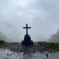
A yellow arrow appears on a damp stone, at the edge of a path disappearing into the forest. There are no groups of pilgrims, no succession of bars, hostels and shops. Only the sound of water, the gradient of the mountain and, from time to time, a hermitage, an old bridge, or the ruins of a building whose purpose nobody quite remembers anymore.
On some stretches of the Camino Olvidado you can walk for hours without crossing paths with another traveller. That solitude is part of its appeal, but also part of its difficulty. Here the Camino de Santiago does not present itself as a perfectly recognisable route, but as a collection of traces scattered across the southern valleys of the Cantabrian Mountains.
The question arises almost inevitably: how can a road be forgotten?
The answer requires beginning with a clarification. “Camino Olvidado” is a contemporary name. It does not appear as a stable designation in continuous medieval documentation. In modern scholarship and popular writing, expressions such as Camino Viejo, Camino de la Montaña and Vexu Kamin are also used. The current name belongs, in large part, to the process of research, recovery and waymarking of the route. The roads, bridges and passes it brings together are far older.
Before there was a great Camino
After the discovery of the tomb attributed to the Apostle James, in the time of Alfonso II, pilgrimage towards Compostela did not immediately organise itself around a single route. The Jacobean map of the early centuries was plural. Those arriving along the Cantabrian coast could head west or penetrate inland by making use of Roman roads, local paths, mountain passes and commercial corridors previously used by the populations of the area.
The official guide to the Camino Olvidado and the record held by the Spanish Federation of Associations of Friends of the Camino de Santiago place the principal Jacobean use of this corridor between the 9th and 12th centuries. The itinerary would have run, in general terms, along the southern face of the Cantabrian Mountains, linking natural passes, valleys and territories under the control of the Christian kingdoms.
There is, however, no medieval guide to the Camino Olvidado comparable to the descriptions that later consolidated the Camino Francés. Nor can it be claimed that every stretch of the currently waymarked route reproduces exactly a road followed a thousand years ago.
Its historical reconstruction rests on a mosaic of evidence: ancient roads, bridges, monasteries, hermitages, hospitals, dedications to Santiago, place names, monastic documents and local traditions of passage.
None of those elements demonstrates on its own the existence of a continuous Jacobean itinerary. A medieval bridge could serve merchants, peasants, livestock or armies. A church dedicated to Santiago does not automatically make the neighbouring path a pilgrimage route. But when those testimonies appear integrated into a coherent network of valleys, passes, settlements and places of shelter, they allow a plausible historical corridor to be recognised.
The Camino Olvidado resembles less an intact manuscript than a book whose pages were scattered across the mountain.
Why it lost its prominence
From the 11th and 12th centuries onwards, the southward advance of the Christian kingdoms transformed communications across the peninsula. The corridor we now know as the Camino Francés offered less mountainous terrain and connected cities, monasteries, markets and hospitals that were increasingly well organised. The great European Jacobean route consolidated there. The southern Cantabrian corridor lost its centrality.
This is also the explanation offered by the official guide and the Federation: when the kingdom of León secured its territories south of the Duero, the Camino Francés steadily grew in prominence until it displaced the earlier routes. This was not necessarily a sudden disappearance, but a slow loss of visibility.
The old roads continued to structure the life of the districts they crossed. Along them moved livestock, agricultural produce, goods and travellers. Later, many of those territories became bound up with mining, the railways and the communications between industrial basins.
The road did not cease to exist in the landscape. It ceased to be told as a Camino.
From Bilbao to the mountains of Burgos
The recovered route sets out from Bilbao and advances to Villafranca del Bierzo, where it joins the Camino Francés. The Federation calculates 515.84 kilometres for the main route, to which it adds more than 188 kilometres of alternative paths. The map produced by the promoting association yields somewhat different figures depending on the variants chosen and how the stages are totalled. For that reason it is more prudent to speak of a route of just over 500 kilometres than to offer a single invariable figure. The complete breakdown can be consulted on the official stages page and in the downloadable map of the Camino Olvidado.
The departure from Bilbao is unconventional for anyone who associates pilgrimage solely with villages, fields and sanctuaries. The route begins at the foot of the cathedral of Santiago and leaves a port and industrial city by following the estuary. It passes through the surroundings of the Guggenheim and, after the so-called Devil’s Bridge, separates from the Camino del Norte to head towards Güeñes. The official description of the first stage traces this transition from urban space to the first valleys.
Gradually the city gives way to the Encartaciones. Güeñes and Balmaseda introduce the walker to a territory marked by bridges, trade and the old communications between Bizkaia and Castile.
In Balmaseda, historic architecture coexists with the memory of industrialisation. From there the road divides. One variant heads towards Nava de Ordunte; another towards Villasana de Mena. The second offers a stage end with more services, while the first approaches the Ordunte reservoir.
Both alternatives lead towards Taranco, a place that various historians have linked to one of the earliest written references to the name of Castile. Further along, the passage through Irús offers one of the most evocative images of the first sector: Atlantic forests, waterfalls and a cobbled road known as the Real Camino de las Enderrozas. These places are described in the stages Nava de Ordunte–Espinosa and Villasana de Mena–Espinosa.
Espinosa de los Monteros marks the transition to more mountainous and less populated terrain. From that point onwards, services begin to thin out and planning becomes as important as physical endurance.
Reservoirs and Romanesque
From Santelices, the Camino advances through a landscape transformed by old infrastructure and large hydraulic works. The area around La Engaña recalls the railway project that attempted to connect these mountains during the 20th century.
The route then reaches Arija, beside the Ebro reservoir. Water now occupies spaces that were once fields, roads and inhabited settlements. In Villanueva de las Rozas, the tower of a church rises from the reservoir and is popularly known as the “cathedral of the fish.” The route through this area is described in the stages Santelices–Arija and Arija–Olea.
After leaving the reservoir, the Camino climbs towards Olea and Cervatos. The collegiate church of San Pedro, one of the best-known Romanesque ensembles on the itinerary, announces the entry into a territory of extraordinary heritage density.
In the Montaña Palentina, the Romanesque does not present itself as an isolated work but as a network of small churches, monasteries and villages. Aguilar de Campoo is one of the great points of rest and resupply. There, the monastery of Santa María la Real distils centuries of religious life, territorial power, abandonment and heritage recovery.
The Camino continues towards Cervera de Pisuerga, passing through the rock-cut necropolis of Corvio, small villages beside the Pisuerga and the hermitage of San Vicente. The official route from Aguilar de Campoo to Cervera de Pisuerga covers some 28.7 kilometres.
Then comes one of the most demanding days on the main route: the approximately 39 kilometres between Cervera and Guardo. The difficulty does not depend on distance alone. The uneven distribution of services means carrying water, food and careful planning. The full stage can be consulted in the official record for Cervera de Pisuerga–Guardo.
León: roads, mines and decisions
From Guardo, the pilgrim can choose between a direct route towards Puente Almuhey or a longer variant via Velilla del Río Carrión, Caminayo and Morgovejo. The second offers more forest, mountain and heritage, but demands greater effort and stable weather conditions.
Puente Almuhey and Cistierna bring the walker into the Eastern Mountain district of León. Here the memory of the Camino mingles with that of the mining basins, the railways and the decline of an industrial economy that for generations transformed villages and valleys. The route advances beneath the presence of Peñacorada and reaches Boñar. At this point the most important decision of the entire itinerary appears.
The main option continues towards La Vecilla, La Robla and La Magdalena. It is more direct and presents more moderate gradients. It suits those walking the Camino Olvidado for the first time or those who prefer somewhat simpler logistics.
The mountain variant heads towards Valdepiélago, Valdorria, Vegacervera, Buiza and La Pola de Gordón. It follows ancient roads, crosses the medieval bridge of Villalfeide and enters landscapes such as the Hoces de Villar, the Faedo de Ciñera and the Calderones gorge.
This is not a simple scenic alternative. The combined stages of Boñar–Vegacervera, Vegacervera–Buiza and Buiza–La Magdalena amount to around 71 kilometres. The tracks linked to the recovery of the Camino accumulate more than 2,300 metres of positive elevation gain for this sequence, making experience, good weather and reliable navigation essential. The official tracks by stage can be downloaded before setting out.
At Boñar, the Camino ceases to be a line and becomes a decision.
Omaña: walking through a rural world
After La Magdalena, the Camino enters Omaña. The landscape changes pace. Great monuments give way to open valleys, pastures, rivers, small bridges and villages whose populations have been declining for decades.
The route passes through Riello, Pandorado and Fasgar, following in places ancient livestock droving roads. Here it becomes clear that the Camino Olvidado was not solely a religious route. It also formed part of pastoral, agricultural and commercial networks.
Before the descent towards El Bierzo, the pilgrim reaches the Campo de Santiago. The place, set among mountains and associated with a local Jacobean tradition, concentrates much of the character of the route: a remote space, connected to Santiago more by the memory of the landscape than by any monumentality.
From Fasgar, the Camino crosses towards Colinas del Campo de Martín Moro Toledano and descends towards Igüeña. Although this stage covers less than twenty kilometres, it includes a significant climb and the passage through one of the most emblematic places on the route. Its layout is found in the stage Fasgar–Igüeña.
The entry into El Bierzo announces itself in the vegetation, the architecture and the growing breadth of the valleys. Labaniego, Congosto and Cabañas Raras form a sequence of small settlements, forests and paths that draw progressively closer to the great Jacobean axis.
The area around Congosto also shows the modern wounds of the territory. The Bárcena reservoir flooded the old crossing of the Sil and currently forces a detour. In January 2026, the Junta de Castilla y León announced the tendering of a 500-metre suspension footbridge between Congosto and Cubillos del Sil, with the aim of restoring proximity to the historic route and avoiding a detour of more than ten kilometres.
Finally, Cacabelos and Villafranca del Bierzo return the walker to the flow of the Camino Francés. The arrival can feel disorienting. After days of solitude, the numerous hostels, the bar terraces and the groups of pilgrims return.
A recovered and still fragile road
The contemporary recovery began in research, popular writing and local memory. The work of José María Luengo Martínez, Julián González Prieto and José Antonio de la Riera Autrán helped to place these mountain corridors within the debate about Jacobean history.
It was then necessary to turn that research into a walkable itinerary: locating roads, defining stages, painting arrows, publishing guides, generating GPS tracks, opening hostels and coordinating associations, local councils and administrations.
In December 2020, the Commission for the Caminos to Santiago through Castile and León recognised the Camino Olvidado as a Historic Camino. It assessed its relationship with ancient and medieval roads, its landscape, its Romanesque heritage, its mining legacy and the degree of waymarking and infrastructure achieved. At the same time, it asked the associations to continue documenting the route through new scientific studies. The content of the resolution can be consulted in the official notice from the Junta de Castilla y León. That double recognition defines its situation well. The Camino Olvidado is a historical and operational route, but its research remains open.
The infrastructure is adequate, though uneven. Accommodation exists at numerous stage ends, but not every village simultaneously offers a bar, a shop, food and a hostel. The Spanish Federation maintains a list of settlements and accommodation, while the official services map provides phone numbers and practical information. Details should be verified before travelling, as openings and conditions can change.
The pilgrim must confirm accommodation in advance, download tracks for offline use and carry reserve water and food. On the mountain variants, the weather can turn an appealing day into a serious problem.
Solitude is part of the experience, but it should not be romanticised. On this Camino it can mean silence and freedom; it also demands self-sufficiency and responsibility.
Reuniting the pages
The Camino Olvidado is not an intact medieval relic. It is a contemporary reconstruction based on ancient roads, documentation, heritage, local memory and associative effort.
That does not make it a less authentic route. All historic caminos changed. They lost bridges, incorporated roads, abandoned villages and modified their courses. On the Camino Olvidado, those transformations are especially visible. Perhaps a road does not disappear when it ceases to appear on maps, but when nobody walks it anymore.
Every pilgrim who crosses the mountains between Bilbao and El Bierzo reunites bridges, hermitages, hospitals and villages that survived for centuries as fragments. To walk the Camino Olvidado is to advance towards Santiago, but also to take part in the collective act of remembering.
AI Transparency Notice
PilgriMaps uses artificial intelligence tools to assist in the research, drafting and translation of editorial content. All AI-assisted content is reviewed, edited and verified by our editorial team before publication. We contrast information against primary sources, specialist literature and on-the-ground knowledge to ensure accuracy, cultural sensitivity and editorial integrity.
AI is one tool among many in our workflow. The judgement, curation and responsibility for everything published on this platform remain entirely human.
Viator Media S.L. — in compliance with the EU Artificial Intelligence Act (Regulation EU 2024/1689).
This post is also available in: