Some paths narrow to the width of a single foot. Below them, hundreds of meters of open air. Protection may consist of little more than an iron chain fixed into rock generations ago. One such place is Mount Hua Shan, in China – often cited among the most hazardous walking routes on the planet.
These itineraries are not designed for everyone. They demand physical preparation, balance, composure, and a measured tolerance for exposure. Yet each year, thousands choose to walk them. Motivations vary: testing limits, seeking intensity, or confronting fear directly. In some cases, their origins lie in spiritual or religious practice. What all walkers share is the understanding that a single misstep can be irreversible.
Mount Hua Shan: The Plank Walk
Shaanxi, China | Elevation: 2,160 m
Described locally as “the most precipitous mountain under heaven,” Mount Hua Shan is one of the Five Great Mountains of Taoism and has received pilgrims since at least the 2nd century BCE. Its contemporary notoriety stems from the Plank Walk: a series of wooden boards, roughly 30 centimeters wide, bolted directly into a vertical rock face.
There are no official fatality statistics. Informal estimates cited by adventure travel media suggest dozens of deaths over the decades. Walkers secure themselves to iron chains fixed into the stone. In some sections, the boards disappear entirely, replaced by shallow footholds carved into the cliff. The exposure below is total.
Mount Huashan: Between Vertigo and Pilgrimage on the Trail of Death
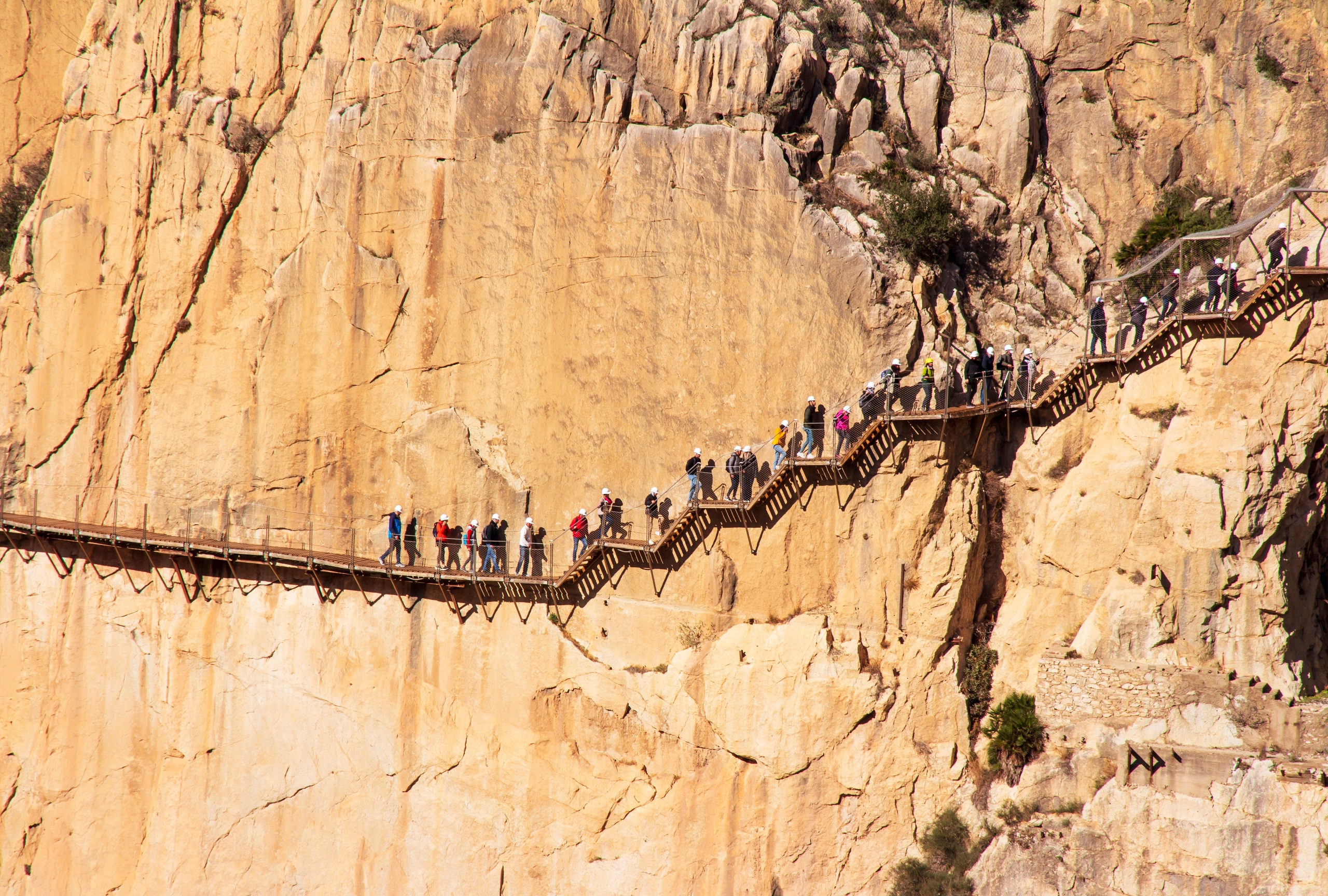
El Caminito del Rey: The King’s Path
Málaga, Spain | Height: ~100 m above river level
Built between 1901 and 1905 to connect hydroelectric facilities – and therefore conceived for purely practical purposes – El Caminito del Rey takes its name from King Alfonso XIII, who crossed it in 1921. For much of the late 20th century, however, it became known primarily for decay and abandonment.
As concrete degraded and sections fell away, the path was reduced to skeletal beams. Between 1999 and 2000, five fatalities were recorded after falls into the gorge. Authorities closed the route. Following a major restoration, it reopened in 2015 with modern walkways, mandatory helmets, and controlled access. Since reopening, no fatal accidents have been officially recorded, while remnants of the original structure remain visible below.
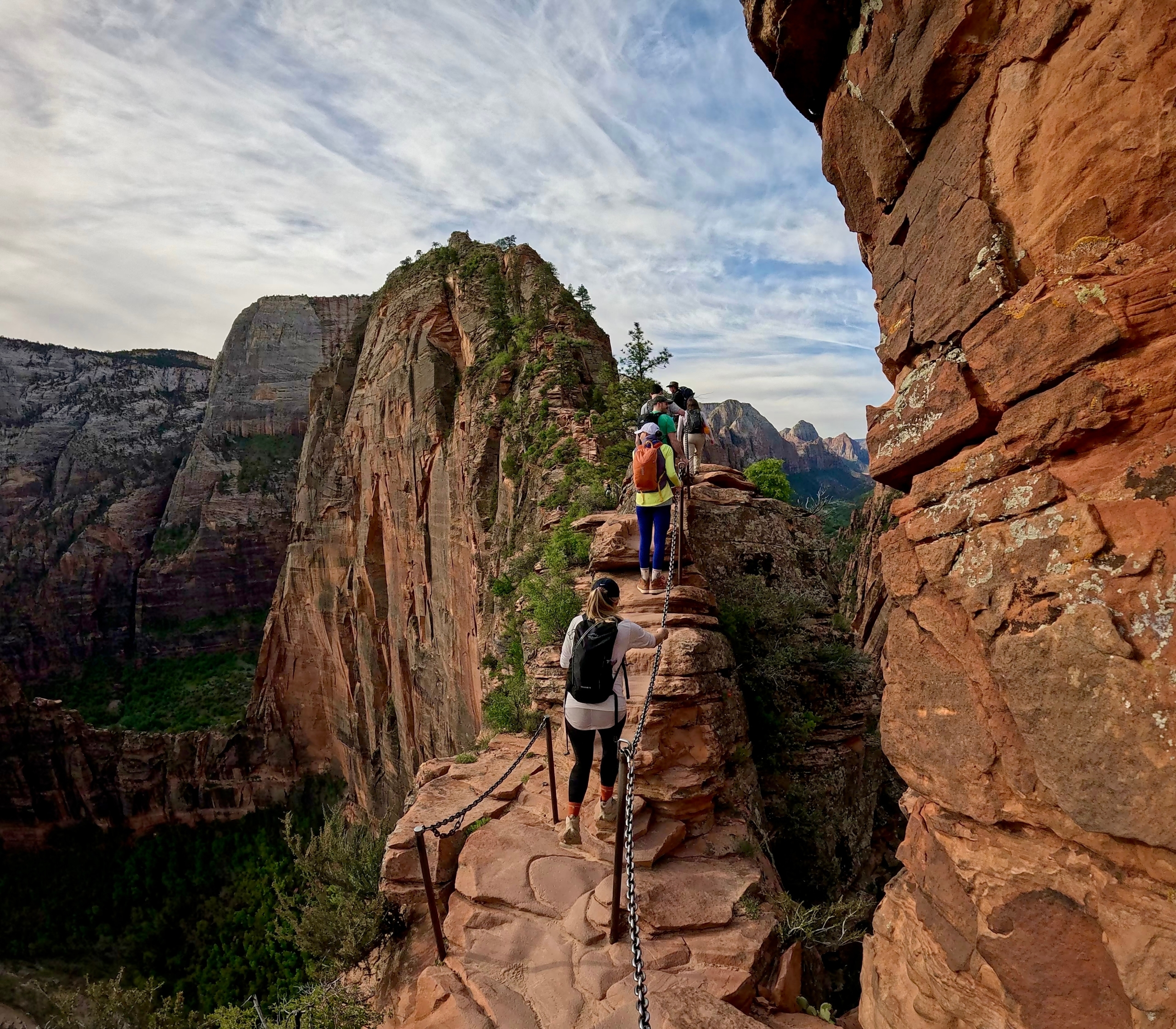
Angels Landing: A Narrow Crest
Utah, United States | Elevation gain: 453 m
Located in Zion National Park, Angels Landing – literally “where angels land” – is a sandstone fin rising sharply above the canyon floor. It is not a pilgrimage site in the traditional sense, but as its name suggests, the spiritual association is unmistakable.
The final ascent follows a razor-thin ridge with drops of more than 300 meters on both sides. Chains anchored into the rock offer limited assistance. Since 2000, at least 18 fatal falls have been documented, many involving experienced hikers. In 2022, a permit lottery system was introduced to reduce congestion on the final section. Early data suggests improved safety outcomes, although the exposure itself remains unchanged.
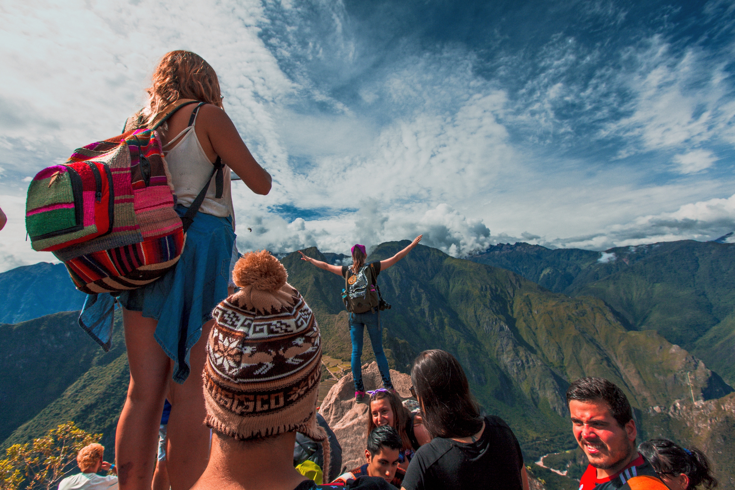
Huayna Picchu: The Steep Ascent
Cusco Region, Peru | Elevation: 2,693 m
Rising behind the iconic ruins of Machu Picchu, Huayna Picchu is known not only for its dramatic proximity to the Inca citadel, but also for housing the Temple of the Moon, a rock-cut sanctuary believed to have had funerary or ritual functions.
Reaching the summit requires ascending a sequence of steep granite steps carved around 500 years ago. The staircase—often referred to as the “stairs of death”—is narrow, worn smooth by centuries of use, and entirely unguarded. The trail measures just 4 km, with a vertical gain of 353 meters. Estimates suggest around 30 fatalities over time, along with numerous injuries. Today, access is limited to 400 visitors per day, and permits often sell out months in advance.
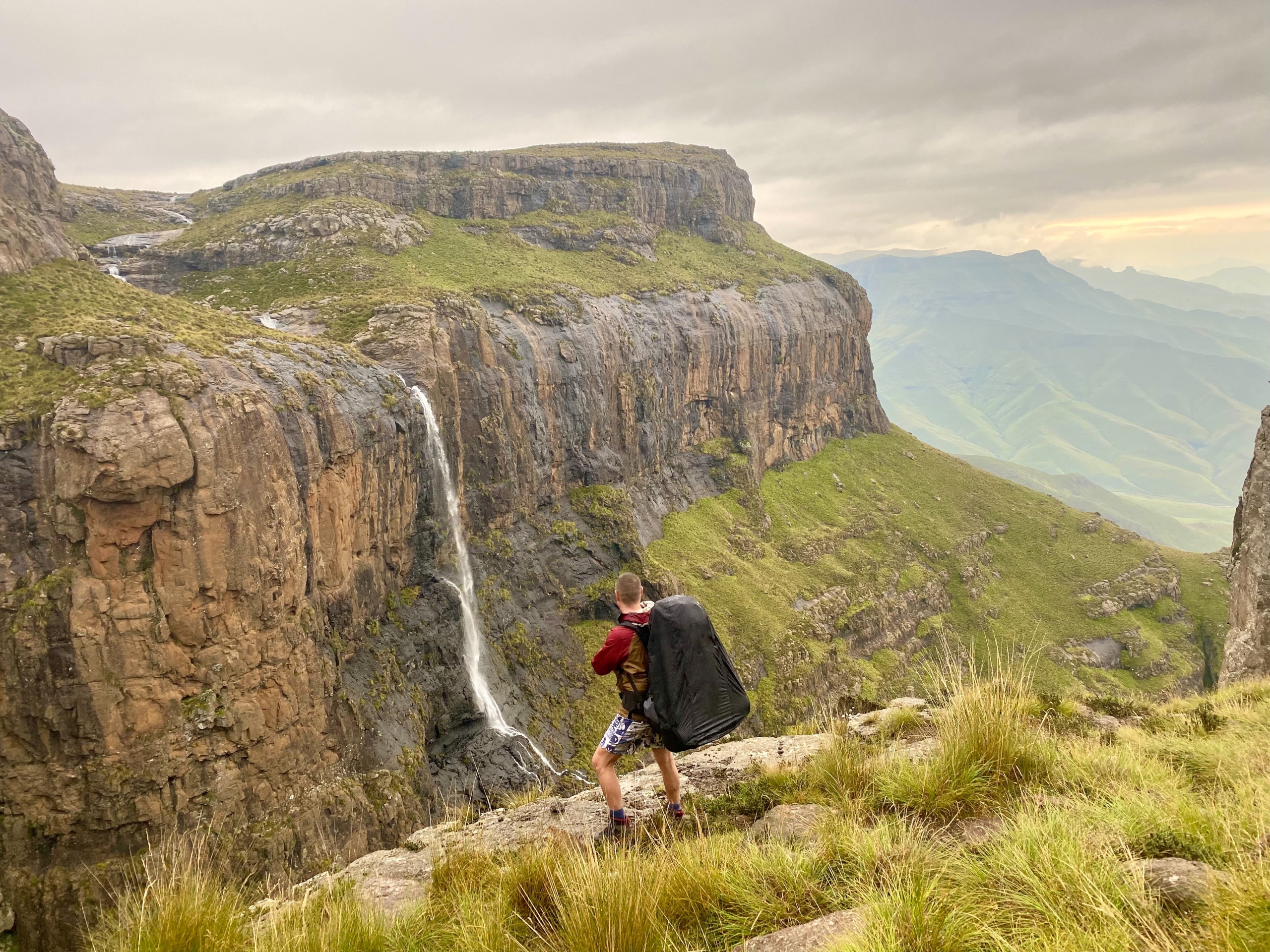
Drakensberg Grand Traverse
KwaZulu-Natal, South Africa | Distance: ~210 km
The Drakensberg range—“Mountains of the Dragon”—hosts one of Africa’s most demanding long-distance routes. The Grand Traverse takes roughly two weeks, crossing high-altitude grasslands, escarpments, and remote valleys without shelters or reliable communication.
Before 1985, official records listed 55 deaths. Since then, fatalities have gone largely uncounted. Risks include sudden storms, navigational errors, injury, and, in some areas, robbery. The Amphitheatre escarpment, often compared in scale to El Capitan, underscores both the scale and seriousness of the terrain.
As a cultural aside, the Drakensberg is also home to Africa’s most significant collection of rock Paleolithic art, and it is widely believed to have inspired J.R.R. Tolkien – South African by birth – in his depiction of the Misty Mountains in The Lord of the Rings.
Kalalau Trail: Along the Nā Pali Coast
Kauaʻi, Hawaiʻi | Distance: 35 km round trip
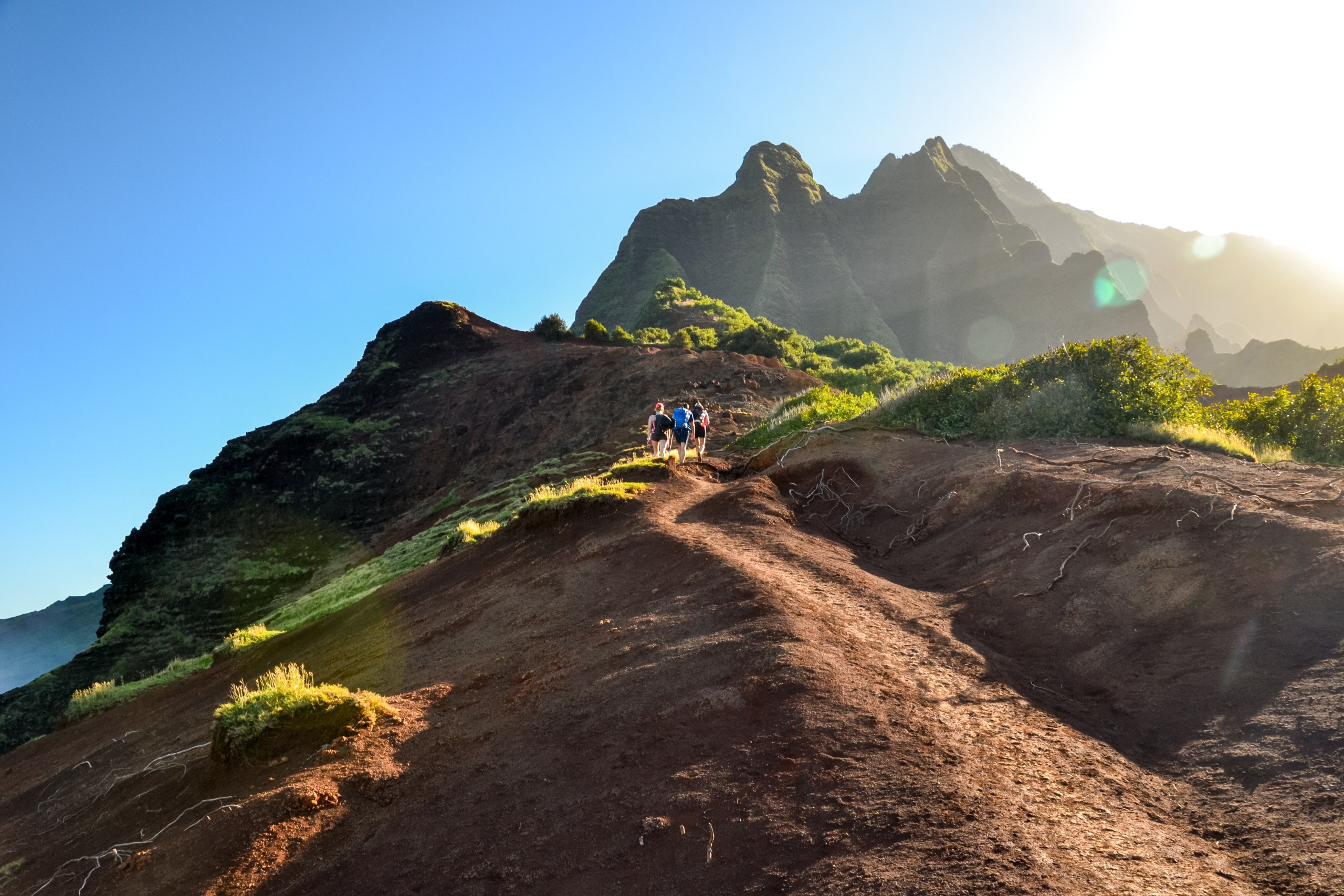
The Kalalau Trail traces the cliffs of the Nā Pali Coast, a landscape known for sharp relief and rapidly changing weather. In Hawaiian tradition, the Kalalau Valley was believed to be the realm of the goddess Hina, mother of the legendary hero Maui, and was revered as a sacred place of refuge and healing.
Hazards include slick mud, exposed drop-offs, and frequent river crossings that can become impassable after rain. In recent years, it has been cited as one of the U.S. trails with the highest number of fatalities. Many deaths occur not on the path itself, but in the surrounding ocean or on wet rock near the coast. Permits are required, and conditions demand constant assessment.
Calculating risk
Why choose such routes? The answer lies in how individuals weigh risk against perceived reward. Completing these paths can produce a strong sense of competence and clarity: confronting fear directly, learning the limits of one’s body, and experiencing landscapes few people see.
Preparation remains essential. Research conditions carefully. Train appropriately. Respect personal limits and environmental realities. The most dangerous route is rarely the one that is openly extreme – it is the one that is underestimated.
AI Transparency Notice
PilgriMaps uses artificial intelligence tools to assist in the research, drafting and translation of editorial content. All AI-assisted content is reviewed, edited and verified by our editorial team before publication. We contrast information against primary sources, specialist literature and on-the-ground knowledge to ensure accuracy, cultural sensitivity and editorial integrity.
AI is one tool among many in our workflow. The judgement, curation and responsibility for everything published on this platform remain entirely human.
Viator Media S.L. — in compliance with the EU Artificial Intelligence Act (Regulation EU 2024/1689).
This post is also available in: