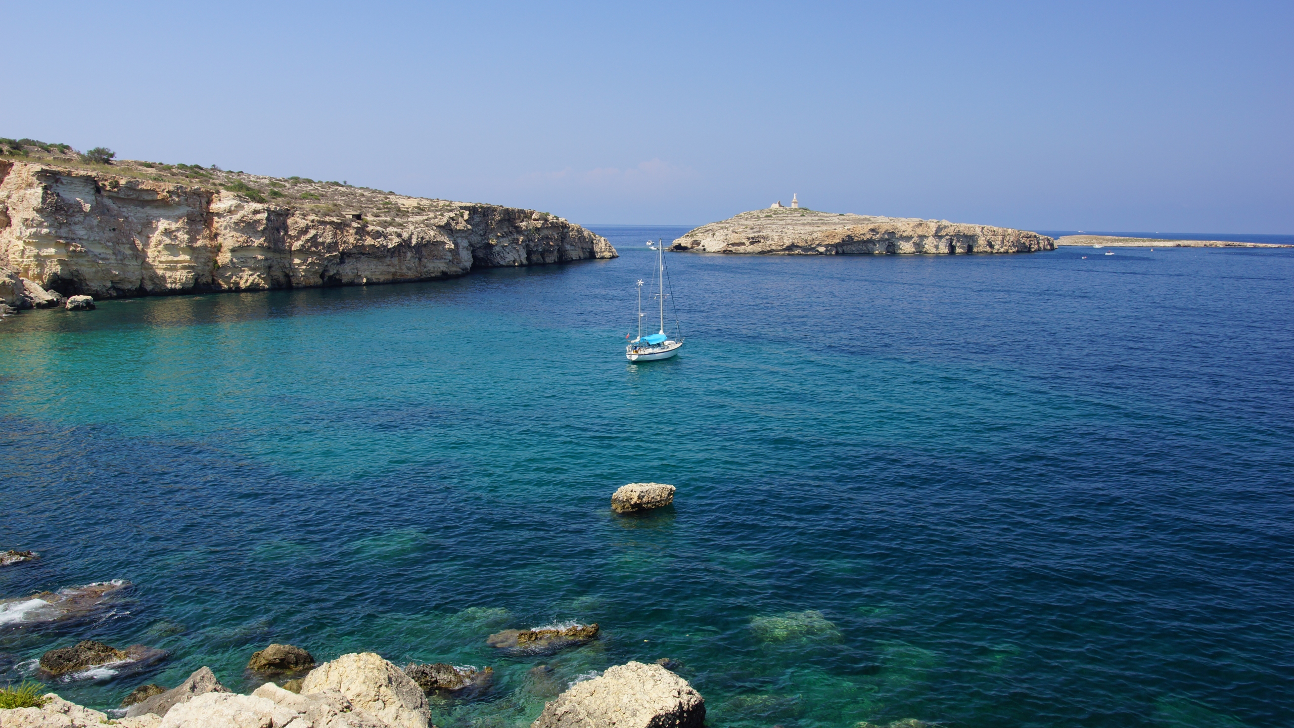
Off the northern coast of Malta, a short distance from Selmun and Mellieħa Bay, two small rocky landmasses rise from the Mediterranean. Known collectively as Saint Paul’s Islets, they form one of the archipelago’s most recognizable offshore landmarks. Though modest in size and uninhabited today, these islets condense layers of history, coastal infrastructure, and contemporary maritime activity into a compact and accessible setting.
For travelers following Malta’s cultural routes, Saint Paul’s Islets offer a different kind of stop: less monumental than urban heritage sites, yet closely tied to both historical memory and present-day uses of the sea.
Geography and access
The islets consist of two main sections – often referred to as Selmunett (the larger island) and a smaller adjacent rock – separated by a narrow channel. In calm weather, the gap appears shallow, reinforcing the impression of a single fragmented landmass.
There is no regular ferry service to the islets themselves. Most visitors encounter them visually from the mainland coast, particularly from the Selmun area, or approach by private boat, kayak, or organized excursion. Their proximity to shore makes them a frequent reference point in coastal navigation and leisure boating.
Despite their apparent accessibility, landing is not always straightforward due to rocky edges and shifting sea conditions. The islets remain largely undisturbed, with no permanent facilities.
Historical layers: From Antiquity to coastal defense
The association of the islets with the shipwreck narrative of Paul the Apostle has shaped their name and cultural resonance, situating them within broader Mediterranean travel traditions. Over time, however, their practical significance became equally important. A huge statue of the Apostle to the Gentiles has dominated the islet since the mid-19th century, alluding to the biblical episode that took place there.
In the 17th century, a coastal watchtower – known as Lascaris Tower – was constructed on the larger islet as part of a wider defensive network across Malta. Commissioned during the period of the Order of Saint John, the tower formed part of an early warning system against corsair raids and maritime threats.
Today, the remains of Lascaris Tower are still visible, though partially ruined. Its presence signals how even small offshore points were integrated into the island’s defensive geography, linking them to a broader system of surveillance and communication.
Archaeological evidence also indicates that the islets were not always entirely uninhabited. In earlier periods, they supported limited human presence – likely seasonal or functional – connected to agriculture or maritime activity. This intermittent occupation contrasts with their current status as a site without permanent residents.
A maritime landscape in use
In contemporary Malta, the waters surrounding Saint Paul’s Islets are active rather than remote. One of the most visible elements is the presence of offshore tuna farms. These large circular sea cages, anchored in deeper waters, form part of Malta’s aquaculture industry, which has developed significantly in recent decades.
For visitors, the tuna farms introduce a modern layer to the seascape. They reflect the economic use of maritime space while coexisting with recreational and touristic activities. Boats navigating the area often pass near these installations, offering a close view of an industry that operates largely offshore.
Diving and coastal exploration
The seabed around Saint Paul’s Islets has gained recognition among divers. The combination of rocky formations, clear waters, and relatively limited coastal development contributes to favorable underwater visibility.
Diving sites in the area feature reefs, drop-offs, and marine life typical of the central Mediterranean. While not as widely publicized as some of Malta’s major wreck dives, the islets offer a quieter alternative for those interested in exploring natural underwater environments.
Snorkeling is also possible in suitable conditions, particularly along the more sheltered sides. As always, local guidance is recommended due to currents and changing sea states.
A visual landmark
Even for those who do not approach by sea, Saint Paul’s Islets function as a visual anchor along Malta’s northern coastline. From viewpoints near Selmun Palace or along the Mellieħa coast, the islets provide a fixed point in the open horizon.
A statue of Paul the Apostle stands on the larger island, installed in the 19th century. Visible from a distance, it reinforces the cultural identification of the site while contributing to its recognizable silhouette.
The surrounding landscape—low vegetation, exposed rock, and uninterrupted sea—creates a setting defined by openness rather than density. Seasonal changes alter the palette, with greener tones in cooler months and dry hues in summer.
Practical considerations for visitors
For those incorporating Saint Paul’s Islets into a broader itinerary, the experience is primarily observational unless accessed by boat. Key points to consider include:
Best viewpoints: Selmun and Mellieħa offer clear coastal perspectives.
Boat access: Available through private charters or guided excursions, weather permitting.
Sea conditions: Can change quickly; local advice is essential.
No services on-site: The islets have no infrastructure, shade, or facilities.
Diving access: Arranged through licensed operators familiar with the area.
Given these conditions, the islets are best approached as part of a coastal exploration rather than a standalone destination.
Between isolation and connectivity
Saint Paul’s Islets illustrate a recurring Mediterranean pattern: small, seemingly peripheral spaces that remain closely tied to wider networks—historical, economic, and cultural. From early occupation to defensive architecture, and from symbolic narratives to aquaculture and diving, the islets have never been entirely disconnected.
Today, they stand uninhabited, yet not unused. Their significance lies precisely in this balance: a place without permanent settlement, but with continuous relevance.
For travelers tracing Malta’s routes – whether historical, coastal, or experiential – the islets offer a concise encounter with the island’s layered relationship to the sea.
This content comes to you in collaboration with VisitMalta
AI Transparency Notice
PilgriMaps uses artificial intelligence tools to assist in the research, drafting and translation of editorial content. All AI-assisted content is reviewed, edited and verified by our editorial team before publication. We contrast information against primary sources, specialist literature and on-the-ground knowledge to ensure accuracy, cultural sensitivity and editorial integrity.
AI is one tool among many in our workflow. The judgement, curation and responsibility for everything published on this platform remain entirely human.
Viator Media S.L. — in compliance with the EU Artificial Intelligence Act (Regulation EU 2024/1689).
This post is also available in: