Andalusia is known for its major urban centers and coastal landscapes, yet its geographic midpoint reveals a setting with a deeper prehistoric background. The city of Antequera stands below a limestone formation whose outline resembles a reclining human figure. In this environment rises one of Europe’s most significant Neolithic monuments: the Dolmen of Menga. Its scale and orientation continue to raise questions about the beliefs and technical abilities of the communities that built it.
The name Antequera derives from the Latin Anticaria, “the ancient one,” reflecting a long record of settlement. Positioned between Málaga and Seville, and between the Mediterranean lowlands and the inland highlands, the area formed a natural crossroads that drew human groups over millennia. Long before the region entered the Roman or Visigothic spheres, and while Europe was emerging from the last glacial period, the local landscape already hosted architectural forms that required coordination and shared purpose.
A Landscape with Deep Prehistoric Roots
Human presence in the Antequera region dates to around 5500 BCE. Excavations at Cueva del Toro in the nearby Torcal karst have produced tools, animal remains, and a small figurine known as the Venus of Antequera. These findings point to early forms of symbolic expression associated with subsistence, fertility, and community identity.
The first Neolithic groups in the area were established farmers and herders. Their ability to organize large-scale construction during this period is one of the key elements that sets Antequera apart in European prehistory. Monumental building required planning, technical skill, and a coherent worldview shared across generations.
The Focus on a Singular Mountain
Among the features of the Antequera landscape, the Peña de los Enamorados holds particular significance. Its 880-meter limestone ridge forms a profile easily distinguishable from a distance. The formation’s human-like outline encouraged local interpretations that described it as a sleeping figure, and its visibility makes it a defining presence in the region.
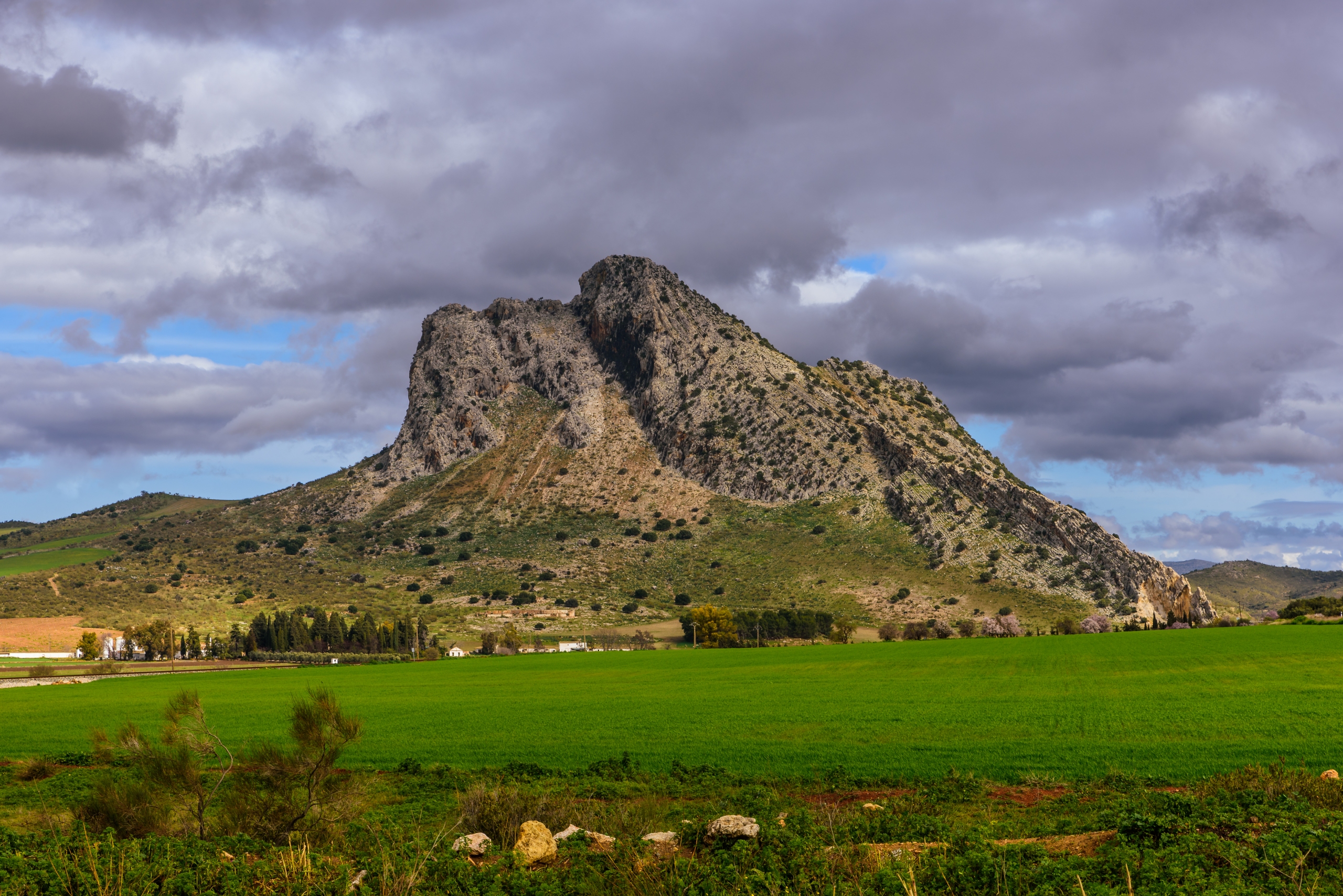
On the mountain’s northern slope, in direct alignment with the Dolmen of Menga, lies the Matacabras rock shelter. Inside, researchers have identified schematic red paintings dated to around 3900 BCE, making it one of the oldest known sanctuaries in Andalusia. This alignment is not incidental. Unlike most megalithic monuments, which tend to follow solar or stellar axes, Menga faces a specific point on the mountain rather than an astronomical marker.
For the Neolithic communities of Antequera, the mountain likely held a role that exceeded its physical dimensions. Its profile may have been associated with an ancestral figure or an earth-related entity. Building a burial chamber oriented toward its outline suggests a relationship between the dead, the living, and the surrounding terrain. In this region, landforms were not inert scenery; they acted as active components within a symbolic system that connected caves, outcrops, water sources, and constructed spaces.
The Dolmen of Menga: A Monumental Structure
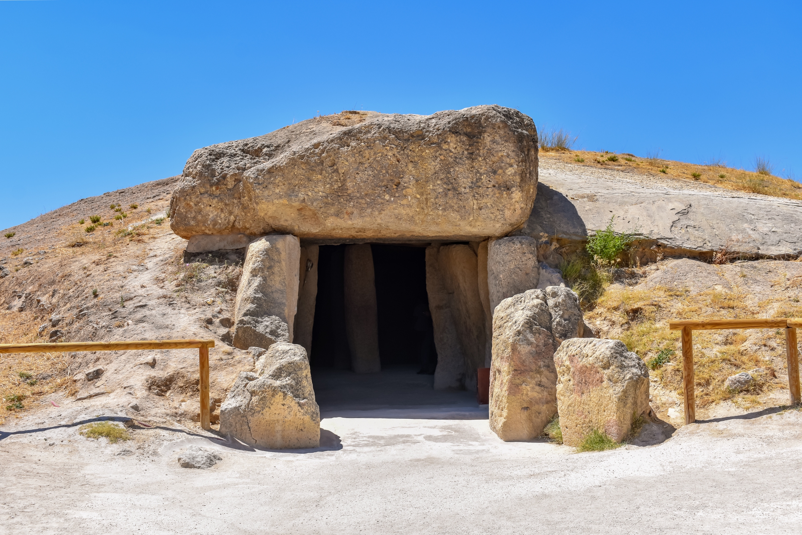
Between 3800 and 3600 BCE, builders erected the Dolmen of Menga, one of the largest megalithic structures on the continent. It extends 27.5 meters in length, with a chamber nearly 6 meters wide, constructed from massive calcarenite slabs weighing up to 180 tons. The technical expertise required for its transport and placement continues to be a subject of archaeological investigation.
The chamber consists of upright stones supporting large capstones, all fitted without mortar. Three interior pillars stand in a straight line but do not touch the ceiling, indicating a symbolic rather than structural function. Some archaeologists interpret them as spatial markers used during rituals or as conceptual supports representing the division of the chamber.
After the chamber was completed, an artificial mound roughly 50 meters in diameter covered the entire structure. This transformed the dolmen into a concealed elevation that blends with the natural terrain and reinforces the monument’s integration with its surroundings.
Architectural Features with Unresolved Interpretations
Several elements distinguish Menga from comparable monuments. At the back of the chamber lies a vertical shaft nearly 20 meters deep, partially filled today by groundwater. Its depth roughly matches the length of the dolmen, creating an axis that links surface activity with the subterranean level. The shaft’s function remains unclear, though its placement suggests ceremonial significance.
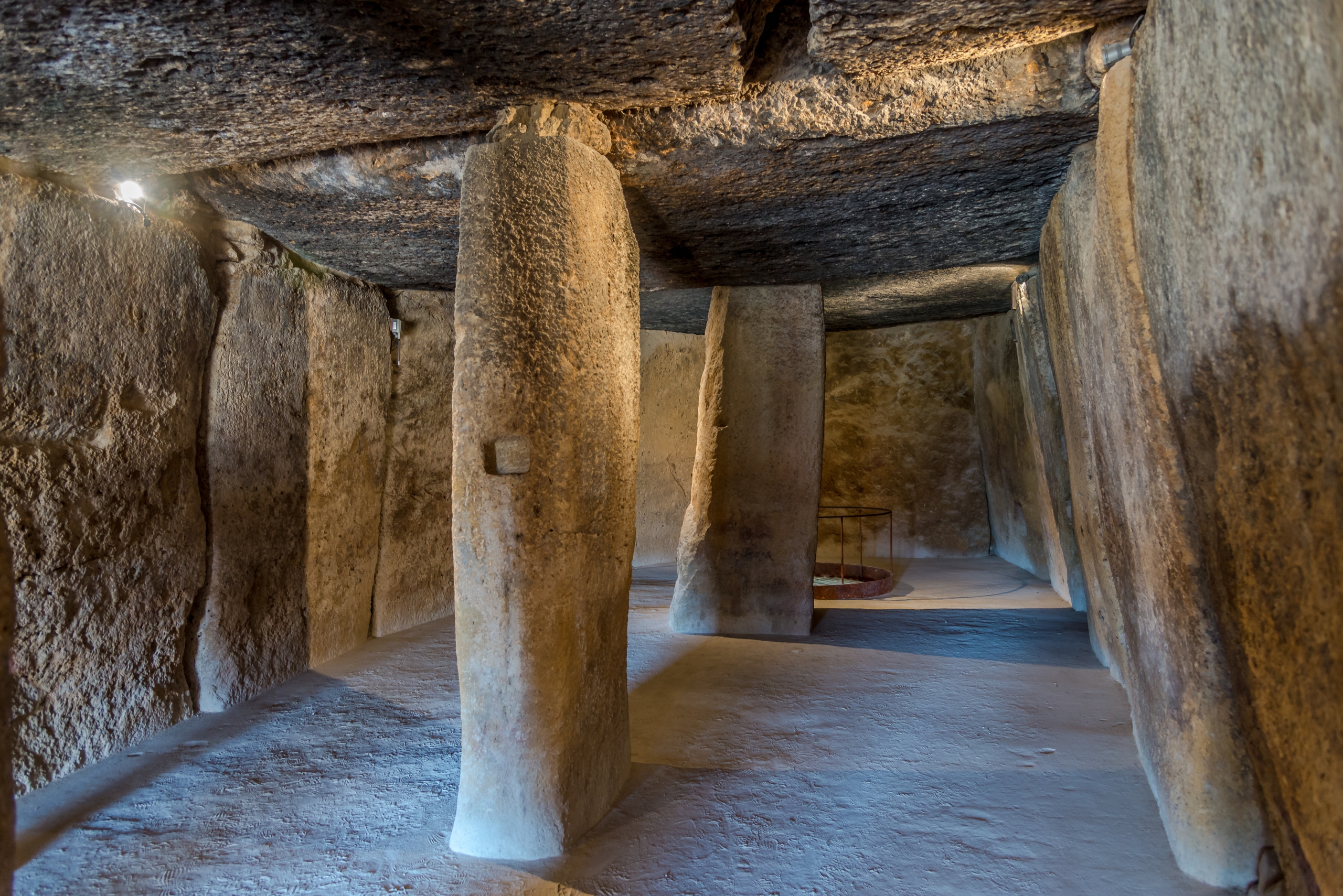
Researchers have also identified engravings in cross and star shapes, as well as traces of white pigment on the stone surfaces. These marks point to a decorated interior with possible ritual or commemorative uses. It is likely that Menga served not only as a burial site but also as a space for collective gatherings and practices connected to memory and identity.
The most distinctive aspect remains its orientation toward the Peña de los Enamorados. Astronomer Michael Hoskin classified this orientation as “anomalous” in the context of global megalithic architecture. This unusual alignment contributed to Antequera’s designation as a UNESCO World Heritage Site. The structure seems designed to frame the mountain itself, establishing a deliberate visual corridor between the monument and the landscape.
A Continuing Field of Research
Current studies continue to refine the chronology of the Antequera megaliths, placing Menga among the earliest in the Iberian Peninsula and contemporaneous with major early monuments elsewhere in the Mediterranean world. Geological work has identified quarry sites with increasing precision, while experimental archaeology has provided plausible transport and construction scenarios.
Evidence shows that the monument remained active across long spans of time. Its role may have changed through successive generations, but it consistently served as a place where architecture, ritual, and landscape converged. The structure is part of a wider network that includes the Viera and El Romeral monuments, each contributing additional insight into regional practices.
Menga stands today as a key source for understanding how Neolithic communities interpreted their environment and expressed collective identity. Its scale, orientation, and internal features invite ongoing analysis, and each new discovery broadens the conversation about prehistoric societies in southern Iberia.
AI Transparency Notice
PilgriMaps uses artificial intelligence tools to assist in the research, drafting and translation of editorial content. All AI-assisted content is reviewed, edited and verified by our editorial team before publication. We contrast information against primary sources, specialist literature and on-the-ground knowledge to ensure accuracy, cultural sensitivity and editorial integrity.
AI is one tool among many in our workflow. The judgement, curation and responsibility for everything published on this platform remain entirely human.
Viator Media S.L. — in compliance with the EU Artificial Intelligence Act (Regulation EU 2024/1689).
This post is also available in: